ℹ️ This action uses Google Maps as a provider to determine road-based distances.
🔍 What It Does
This tool compares two points and returns the distance between them based on the specified measurement system (metric or imperial).✈️ Use this to estimate delivery travel, calculate commute range, or qualify leads based on location proximity.
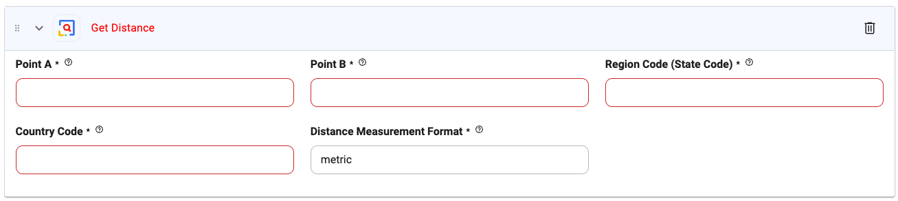
🖼️ Action Interface
⚙️ Configuration Options
Point A (required)
Point A (required)
Type:
string
Origin address or coordinate (latitude,longitude).Example: 1600 Amphitheatre Parkway, Mountain View, CAPoint B (required)
Point B (required)
Type:
string
Destination address or coordinate.Example: 1 Infinite Loop, Cupertino, CARegion Code (State Code) (required)
Region Code (State Code) (required)
Type:
string
Subdivision or state code where the search takes place. Helps with disambiguation.Example: CA for CaliforniaCountry Code (required)
Country Code (required)
Type:
string
ISO 2-letter country code.Example: US, GB, INDistance Measurement Format (required)
Distance Measurement Format (required)
Type:
string
Choose between metric (kilometers) or imperial (miles).Default: metric🔧 Tips
- Make sure addresses are clean or properly formatted for best results.
- Supports use of
@parametersfor dynamic route calculations. - Use the output as a filter condition for radius-based logic (e.g., “is within 20 miles?”).